Trip Report
Bedal Peak
Claire Kamak
6/19/2020
Permits: National Forest Pass
Difficulty: Moderate
Route Name: Northwest Ridge
Snow Level: 4200 ft
Elevation Gain: 4300 ft
Total Miles: 6.00 mi
Gear: Ice axe. Trekking poles if desired.
Weather: Upper 60s, mostly clear skies, and beautiful. Little to no wind, high humidity.
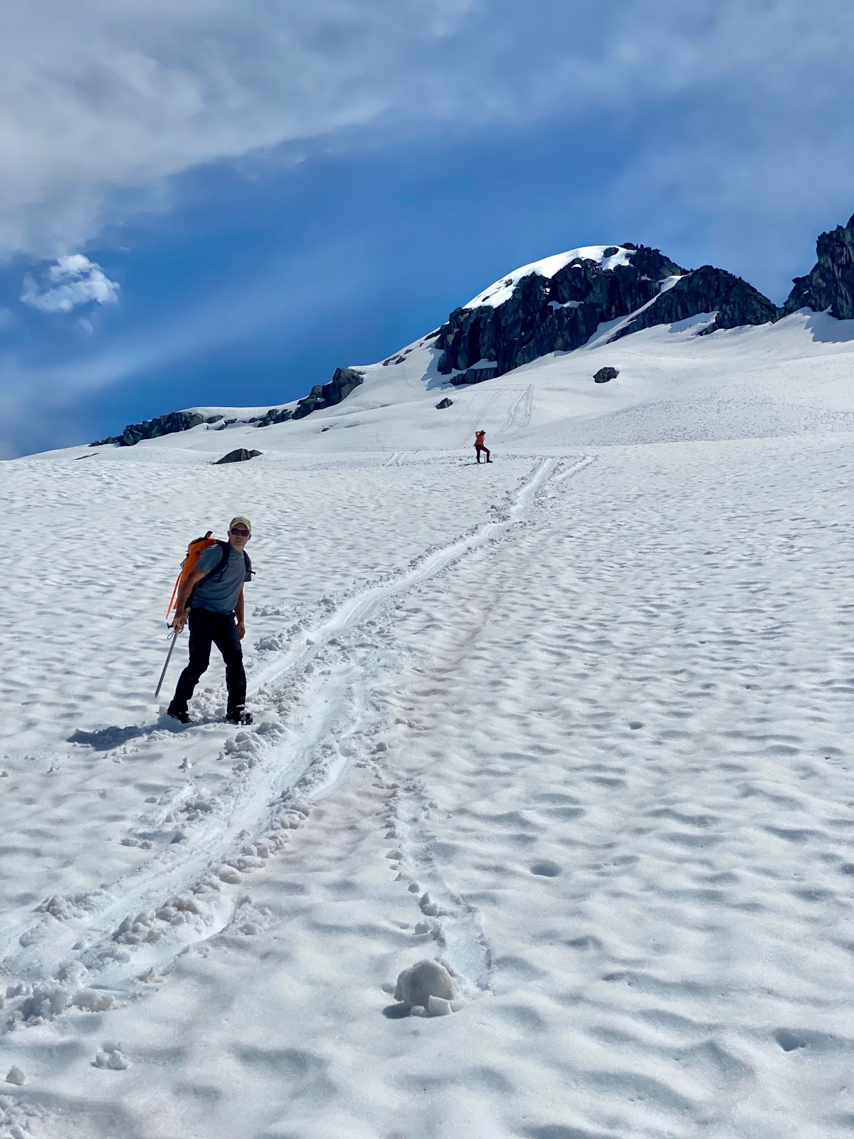
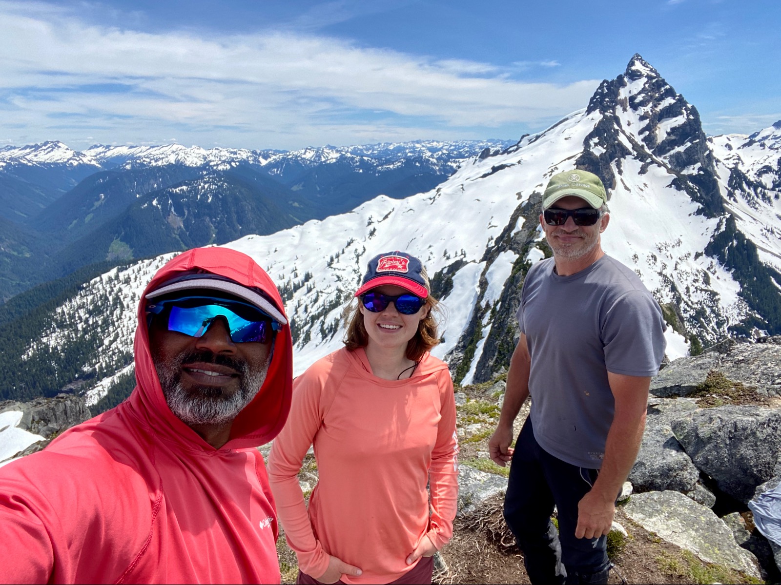
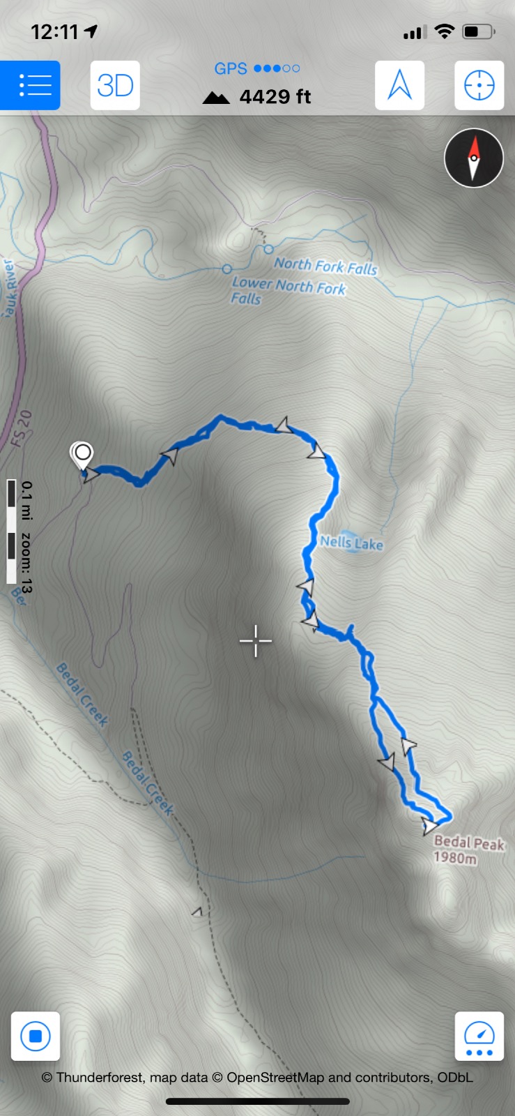
Park at the hairpin bend around 2,200’ on FR 4096, find the trailhead marked by tape just up from the bend (not easily seen). The trail is marked by pink and blue tape for the most part and goes straight up from the road before traversing northeast, east. A couple creek crossings, not difficult, and lots of downed trees to make for a fun obstacle course. Cross over two major boulder fields. Follow the northwest ridge and cross the gully over to the next ridge at about 5,000’. Continue southeastward toward the peak up moderate snow. Two options to get to the peak; either circle around to the east side and go up snow or hug the northwest ridge, scramble up some rock to get to snow and walk to peak. The peak was snow free with 360 views of greatness. You can see Sloan, Glacier Peak, Mt. Baker, Rainier, and many other peaks this vantage point. Descend the snow around the east side off the peak and follow your tracks back.
Info
- Latitude: 48.06860
- Longitude: -121.35430
- Elevation: 6554ft
- PeakBagger Link


Comments
[[comment.first_name]] [[comment.last_name]]
[[comment.time]]
[[comment.comment]]